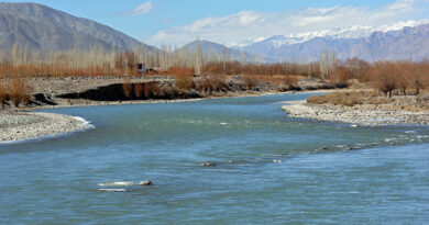
UK researchers remap world’s rivers to improve water management, flood modelling
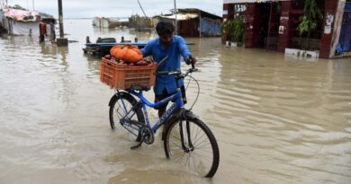
Rivers support life, supplying water to millions of people in their catchments. But, the same rivers also pose growing risks. As rainfall becomes more erratic and sea levels rise, floods are expected to become more frequent and severe in many parts of the world.
Now, a team led by researchers at the University of Oxford has created the most complete map of the world’s rivers ever made offering a major leap forward for flood prediction, climate risk planning, and water resource management in a warming world.
Existing global river maps are outdated and overly simplified, assuming that rivers flow in a single direction and never split. They often overlook complex features, such as when a single river channel splits into multiple channels. These branching river systems are important because they are often found in densely populated, flood‐prone regions, and they are crucial for understanding water movement across the Earth’s surface.
The team has developed a new global river network called Global River Topology (GRIT), which includes these branching rivers and large canals, capturing the complexity. The new mapping system shows how rivers really flow, branch, and connect landscapes and also address the limitation of existing river maps used for water management and flood prediction
According to an official statement, GRIT was created by combining high‐resolution satellite imagery of rivers with advanced elevation data of the earth’s surface. GRIT not only includes the main river channels but also provides information on river flow directions, widths, and points where rivers split. The GRIT river network has a total length of 19.6 million km and includes 67 thousand bifurcations. GRIT stands to significantly enhance applications in hydrology, ecology, geomorphology, and flood management.
“We needed a global map that reflects the way rivers actually behave”, said Dr Michel Wortmann, who developed GRIT at Oxford as a Research Associate on the EvoFLOOD project. “It’s not enough to assume rivers just go downhill in a straight line—especially not when we’re trying to predict floods, understand ecosystems, or plan for climate impacts. This map shows the world’s rivers in their full complexity”.
Rivers are vital for ecosystems and human life, but as climate change drives more extreme weather, they are becoming increasingly dangerous—especially during floods. To prepare, scientists and governments need to understand where water is likely to go at large scales. GRIT allows for a far more complete view of water movement, helping to improve flood models, water management systems and disaster planning.
The new river network also supports the development of global data-driven (AI) models for flooding, drought, water quality, habitat conservation, and environmental risk.
While GRIT already marks a big leap forward, the Oxford team notes that it’s just the beginning.
“GRIT has been built to evolve”, said Louise Slater, Professor of Hydro-climatology at the School of Geography and the Environment, University of Oxford. “Because it’s fully automated, in contrast with previous global networks, we can keep updating it with the latest satellite images and topographic data, to understand shifts in the rivers and landscape”.