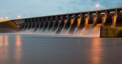
Geospatial technologies remain invaluable for water sector

Agendra Kumar
As a rapidly developing and second most populous country in the world, India is facing a severe water crisis that is becoming a critical issue for people and politicians alike. Home to about 17% of the world population, and around 20% of world’s livestock population, India has access to only about 4% of the world’s freshwater reserves. Access to clean drinking water is also a challenge that the government is trying to address through mission mode projects.
In view of the challenges that pervade water resources and water utility services in our country, the Government of India has taken numerous steps to address the issue, while emphasizing on the use of technology for the purpose.
One of the key technologies that play a critical role for the water sector is geospatial technology, which is an umbrella term given to a host of technologies that acquire, store, maintain, and disseminate precise geographic information about the features and entities on the earth’s surface and sub-surface, allowing for a comprehensive understanding of trends and patterns. It includes technologies like remote sensing, satellite imagery, surveying, mapping, global navigation satellite systems (popularly known as GPS), LiDAR, Geographic Information System etc. Such data and analytics bear applicability for every sector, including water resource management, utilities, transport infrastructure, housing, healthcare, disaster management, etc.
Role of geospatial technology in water sector
Geospatial technology is used for watershed conservation, its delineation, efficient planning and management of water distribution system, identifying sources of water like lakes, rivers, ponds, and potential groundwater zones. Terrain models created using GIS, provide flow modeling and debris flow probability to understand the condition of watersheds. It also helps create a Digital Elevation Model (DEM) of watersheds to represent delineation and drainage pattern which is used to study parameters like its flow direction, drainage network and slopes.
Geospatial technology in conjugation with various sensor-based technologies helps maintain up-to-date data for effective decision making and streamline essential processes providing improved insight that results in better operations, planning and water distribution. In water distribution management the technology helps in identifying leakages and manage adequate water pressure. A combination of GIS in preparing hydrologic models can serve as an effective tool for decision makers in the distribution and movement of water.
Spatial analysis helps in reducing water wastage and energy consumption required for water pumping and treatment. With the help of dynamic asset management tools, GIS technology helps in reducing the gap between the capital investment and available financial resources in water distributing channel. Additionally, GIS also helps in monitoring water quality below and above the ground by measuring oxygen, pH, bacterial content, etc. and measures flow rate of water and turbidity.
Remote sensing technology can help in preparing high resolution 3D maps of potential groundwater zones and further dividing it into different categories depending upon the water level. The technology can also help define the surface water bodies, estimate meteorological variables such as temperature and precipitation, assess hydrological state variables like soil moisture and land surface characteristics, and estimate evapotranspiration.
The technology is also applied to predict rainfall, flood forecasting, management of water in rivers, mapping and monitoring of snow through mapping snow-cover extent and snow mass, studying water reservoir sediments, etc.
The Association of Geospatial Industries (AGI), a non-profit industry-led body, hopes to bring together stakeholders of the Indian geospatial ecosystem to exchange ideas, vision, and good practices on geospatial applications for water resources and utilities, as part of the annual India Geospatial Leadership Summit.
The theme for the summit this year was “Geospatial Technologies for Water Security,” and over the course of the three-day event, several key issues and solutions to help India achieve its goal of water security would be discussed.
Among the range of themes to be discussed would be development and management of water resources with geospatial technologies, interlinking of rivers and river development, innovation and practices for water security, water availability and access, water related disasters and monetizing water.
During the Summit, AGI India will also confer excellence awards to government or private user organizations of geospatial technologies doing exemplary work in fields like water conservation, river rejuvenation, water distribution, watershed development and more.
(The author is President, Association of Geospatial Industries.)
(Disclaimer: India Water Review does not take any responsibility for the views expressed in the article. The article published also does not in anyway reflect the opinion of India Water Review.)