Glacial lakes in the Indian Himalayas expanding rapidly, warns ISRO
India’s state-run space agency Indian Space Research Organisation (ISRO) has issued a stern warning that glaciers across the Himalayas are melting at an unprecedented rate, resulting in significant expansion of the glacial lakes.
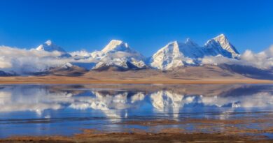
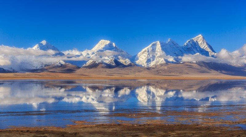
The mountain ranges, often called the ‘Third Pole’ due to their vast glaciers and snow cover, are highly vulnerable to climate change impacts. ISRO said new research, that analysed decades of satellite imagery, has revealed that glaciers across the Indian Himalayan region have been melting at alarming rates, leading to formation of new lakes and the enlargement of existing ones in the Himalayan region.
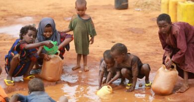
While these glacial lakes play a crucial role as freshwater sources for rivers in the Himalayan region, they also pose significant risks, such as Glacial Lake Outburst Floods (GLOFs), which can have devastating consequences for communities downstream.
GLOFs occur when glacial lakes release large volumes of meltwater due to the failure of natural dams, such as those made of moraine or ice, resulting in sudden and severe flooding downstream. These dam failures can be triggered by various factors, including avalanches of ice or rock, extreme weather events, and other environmental factors, said ISRO in an official statement.
Research conducted worldwide has consistently shown that glaciers across the globe have been experiencing unprecedented rates of retreat and thinning since the onset of the Industrial Revolution in the 18th Century.
Monitoring and studying the occurrence and expansion of glacial lakes in the Himalayan region is challenging due to inaccessible and rugged terrain. Satellite remote sensing technology proves to be an excellent tool for inventory and monitoring due to its wide coverage and revisit capability. Assessing long-term changes in glacial lakes is crucial for understanding glacier retreat rates, assessing GLOF risks, and gaining insights into climate change impacts.
Satellite data archives spanning the past three-four decades provide valuable insights into changes occurring in glaciated environments. Long-term satellite imagery covering the catchments of Indian Himalayan river basins from 1984 to 2023 indicates significant changes in glacial lakes.
Of the 2,431 lakes larger than 10 hectares identified during 2016-17, 676 glacial lakes have notably expanded since 1984. Specifically, 130 of these lakes are situated within India, with 65, 7, and 58 lakes located in the Indus, Ganga, and Brahmaputra River basins, respectively.
Of these 676 glacial lakes, as many as 601 lakes (89 per cent) have expanded more than twice while 10 lakes have grown between 1.5 to 2 times and 65 lakes at 1.5 times. Also, elevation-based analysis reveals that 314 lakes are located in the 4000-5000 m range and 296 lakes are above 5000 m elevation.
The glacial lakes are categorized based on their formation process into four broad categories, namely Moraine-dammed (water dammed by moraine), Ice-dammed (water dammed by ice), Erosion (water dammed in depressions formed by erosion), and other glacial lakes. Among the 676 expanding lakes, the majority of them are Moraine-dammed (307) followed by Erosion (265), other (96), and Ice-dammed (8) glacial lakes, respectively.
Long-term changes in the Ghepang Ghat glacial lake (Indus River Basin) at an elevation of 4,068 m in Himachal Pradesh, India, show a 178 per cent increase in size from 36.49 to 101.30 hectares between 1989 and 2022. The rate of increase is about 1.96 hectares per year.
Satellite-derived long-term change analyses provide valuable insights for understanding glacial lake dynamics, which are essential for assessing environmental impacts and developing strategies for GLOF risk management and climate change adaptation in glacial environments, said ISRO.