Largest study of Asia’s rivers to help predict changes in region’s water cycle
The largest ever research study of Asia’s rivers conducted by a Singapore-based team may help predict changes in the region’s water cycle. The research study, which has unearthed 800 years of paleoclimate patterns across Asian rivers, is expected to give policy makers and scientists a leg up in assessing future climatic changes and making more informed water management decisions.
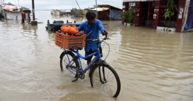
‘Mega-droughts’ of the past have often simultaneously hit sites that are currently home to power production along Asian rivers, the study that looked at 813 years of annual river discharge at 62 stations across 41 rivers in 16 countries from 1200 to 2012, noted.
The team of researchers at the Singapore University of Technology and Design (SUTD) produced the study after two years of research in order to better understand past climate patterns of the Asian Monsoon region.
Home to many populous river basins, including 10 of the world’s biggest rivers including the Ganga, Mekong and Brahmaputra, the Asian Monsoon region provides water, energy, and food for more than three billion people. This makes it crucial to understand past climate patterns so that long-term changes in the water cycle and the impact they will have on the region’s water supply can be better predicted.
“To manage these critical resources, we need a better understanding of river discharge — how does it change over a long time? Are there common variation patterns among rivers? To answer these questions, we use information derived from tree rings to reconstruct average annual river discharge history at 62 gauges in 16 Asian countries”, the authors noted.
“Our reconstruction reveals the riparian footprint of mega-droughts and large volcanic eruptions over the past eight centuries. We show that simultaneous droughts and pluvials have often occurred at adjacent river basins in the past, because Asian rivers share common influences from the Pacific, Indian, and Atlantic Oceans”.
To reconstruct histories of river discharge, the researchers also relied on tree rings. An earlier study in 2010 had developed an extensive network of tree ring data sites in Asia and created a paleodrought record called the Monsoon Asia Drought Atlas (MADA). SUTD researchers used the MADA as an input for their river discharge model.
The team developed an innovative procedure to select the most relevant subset of the MADA for each river based on hydro-climatic similarity. This procedure allowed the model to extract the most important climate signals that influence river discharge from the underlying tree ring data.
“Our results reveal that rivers in Asia behave in a coherent pattern. Large droughts and major pluvial periods have often occurred simultaneously in adjacent or nearby basins. Sometimes, droughts stretched as far as from the Godavari in India to the Mekong in Southeast Asia. This has important implications for water management, especially when a country’s economy depends on multiple river basins, like in the case of Thailand,” said first author Nguyen Tan Thai Hung, a PhD student from SUTD.
The study, which was published in the journal Water Resources Research, noted that the findings have important implications for water management and power production, especially when a country’s economy depends on multiple river basins.
Using modern measurements, it has been known that the behaviour of Asian rivers is influenced by the oceans. For instance, if the Pacific Ocean becomes warmer in its tropical region in an El Nino event, this will alter atmospheric circulations and likely cause droughts in South and Southeast Asian rivers.
However, the SUTD study revealed that this ocean-river connection is not constant over time. The researchers found that rivers in Asia were much less influenced by the oceans in the first half of the 20th century compared to the 50 years before and 50 years after that period.
“This research is of great importance to policy makers; we need to know where and why river discharge changed during the past millennium to make big decisions on water-dependent infrastructure. One such example is the development of the ASEAN Power Grid, conceived to interconnect a system of hydropower, thermoelectric, and renewable energy plants across all ASEAN countries. Our records show that ‘mega-droughts’ have hit multiple power production sites simultaneously, so we can now use this information to design a grid that is less vulnerable during extreme events,” said principal investigator and study co-author Associate Professor Stefano Galelli from SUTD.